Saturday, May 16, 2009

Ventana Wilderness - 14 Mile Out and Back to Junipero Serra Peak

Date: 5/15/2009 - 5/16/2009
Distance: 14 miles out and back
Elevation: 3,500' + gain/loss
Weather: High 90s, sunny and hot hot hot!

I got a chance to pack in one more spring trip to Ventana Wilderness once again thanks to the keen organization of Jim M., this time through the San Jose Hiking Meetup. This time we would climb to the top of Junipero Serra Peak. At 5,853' Junipero Serra is the highest point in the Santa Lucia Mountains -- California's central coast range.

A small group of us went down the night before the hike to enjoy some camping and mountain biking in Los Padres National forest. On our way to the campsite we stopped and checked out Fort Hunter Liggett -- the Army base adjacent to the forest.

Here we go with the pictures...

The Hacienda on Fort Hunter Liggett. This was designed by the same architect that designed the (William Randolph) Hearst Castle near San Simeon. Jim, Bill and I had a pitcher of beer here on our way through the base.


Rabbit hanging outside the Hacienda.


Driving through Fort Hunter Liggett on the way to Los Padres National Forest. Jim and Bill in the jeep up ahead. We had a couple of these water crossings along the way.


Looking up towards Junipero Serra Peak the evening before the hike. The meadows around the trailhead have tons of cool boulders to climb on.


On my mountain bike ride the morning before the hike.


Morning in Ventana.


A waterfall flowing into a swimming hole along Arroyo Seco Road.


The swimming hole.


The register at the trail head for Junipero Serra Peak.


Charred pine cones along the trail.


Jim riding an old broken down tractor we found along the way.


Elena takes a turn on the tractor.


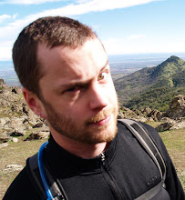
Eric and Adam blazing a path for us to follow.


Eric in a sea of ferns.


Once upon a time a sign.


Late spring wildflowers were abundant.


The bloom of a Yucca plant.


Ascending out of the valley on the way to the peak.


A rough hand-stiched panorama taken about 2/3 of the way up the mountain. This shot is looking west to Cone Peak on the far western border of Ventana Wilderness. The Pacific Ocean lies directly on the other side of that ridge.


This was a fantastic late spring trip in what could easily become my favorite California wilderness area. However the blazing heat and incessant bugs in our faces told me it was time to lay off any more seriously strenuous Ventana adventures until next spring. Ventana in summer is an unforgiving place indeed!

Sunday, May 10, 2009

Checking Out the "How Weird Street Faire" - San Francisco, CA

Date: 5/10/2009

Gina and I went up to San Francisco with our friends Ariella and Amit to check out the How Weird Street Faire. Definitely lots of weird, wacky and wonderful things to be seen there.

Entering the festival.


Dancing 'round the boom box.


Gina, Ariella and Amit in the background. Random raver chics dancing in the foreground.


Ariella and Amit.


No party this sound system can't get to.


In the jungle.


Wicker and disco, what a combo.


Festival food.


Pooh slippers.


Lots of women walking around on stilts.


Impressive dreads.


Basket case.


LOL indeed!

Sunday, May 3, 2009

Multi-Sport Adventure in Ventana Wilderness - Biking, Hiking to Tassajara

Date: 5/02/2009
Distance: 10 miles mountain biking, 10 miles hiking (very approximate)
Elevation: 6,000' total gain (very approximate)
Weather: 50s-70s, overcast

No other area has called my name more than Ventana since I've started exploring the wild places of the Bay Area. Unfortunately, shortly after I got one quick glimpse last spring (out and back hike to Manuel Peak), the area was subject to massive wildfires. It was subsequently closed to the public for over a year. The area was originally slated to be opened 6/1/2009, but we got a nice surprise, and the forest service saw fit to open the area up a month early. This is significant, since spring time is the time to go to Ventana with cooler temperatures, less bugs and lots and lots of wildflowers. It was no small deal when I got an invite from my friend Jim for a day of multi-sport adventure deep into the Ventana Wilderness on May 2, one day after the re-opening. Jim is a guy who knows the area well, and knows extreme adventure well. We couldn't go wrong.

Our route started on Tassajara Road, the dirt road leading to Tassajara Hot Springs, the site of the first Buddhist monastery to be built outside of Asia. Tassajara Road starts out smooth but steep, taking hikers, bikers and vehicles up up and away, deep into the Santa Lucia Mountains. At 4,000'+ elevations it twists and turns over rocky terrain through eye-poppingly beautiful mountains, before eventually descending to the site of the monastery along the banks of Tassajara Creek. We would take the road all the way to the top by bike, before locking our bikes to trees and beginning the descent to the monastery on foot.

To the top of Tassajara Road by bike....

On the way up Tassajara Road, entering burn zone.


Elena on Tassajara Road.


Bill motoring up through the burnt out trees.


Cool looking white trees.


Church Ranch Road. This would be the return path of our hiking loop.


Among the hazards of recreating in a fresh burn zone. This big tree was missing large portions of its trunk.


Jim cruising through the Santa Lucia Mountains.


Jim and Elena survey the scene.


Spring flowers over the mountains.


Flowers along a rocky outcrop.


Flowers....


...and more flowers.


Mountain panorama.


Time to lock the bikes for our wilderness hiking loop...

Our group descending Tassajara Road.


A water fill up spot. That's a bathtub at the bottom.


Looking down into the canyon we are entering.


A view of Tassajara Road descending along the face of a ridge.


Tassajara Creek flowing with mud.


Doll found along the creek, close to the monastery.


Blue flowers near the Tassajara Creek.


Jim crossing a log bridge.


Nice rock formation.


Elena in the rocks.


Noah in the rocks.


Our rocky path.


After passing through this rocky zone the path got hairy fast. Trail gave way to increasingly thick vines, waist-high grasses, burnt out thickets and big rocks. The camera went away for some serious scrambling, bouldering and belly crawling to get out of the last creek and up to Church Ranch Road, our path back out to our bikes.

The final three miles of the hike climbed a smooth, wide, fire road. This gave me the chance pull the camera out and snap a few parting photos in the early evening sun.


Summary: Ventana is every bit as spectacular as I imagined and more. Stunning mountains, beautiful spring wildflowers, extremely rugged terrain. Explore with much caution until you know the area and watch for hazards from recent wildfires. Fire roads provide reliable access for scouting, even in the burnt areas.

Note about the distances. I shaved off several miles on the downhill bike ride at the end by hitching a ride with a couple of friendly locals (motorized vehicles are allowed on Tassajara Road).