Distance: 17.5 miles (approximate)
Elevation: 4,000' total gain (approximate)
Weather: 60s-80s, sunny
A two day, one night backpacking adventure in the Cache Creek Wilderness, organized by David N. of Wildcat fame. CCW is a beautiful, rugged stretch of lands in the Vacca Mountains north of Napa, CA. The area is managed by the BLM and is mostly used by hunters, as well as hikers of especially sturdy stock.
Day One
From Cache Creek Canyon we ascend up and along the Blue Ridge, heading south to visit Fiske and Lowery Peaks respectively. From Lowery Peak we work our way down the other side of the ridge to Fiske Creek, where we setup camp for the night. Along the way we enjoy huge views of Northern California from Lassen Peak in the north to the Sutter Buttes and Sierra Nevada in the east to Mount Diablo in the south.
David N., leader of the Wildcat Pack, plots course.

The bullet holes are a good sign we're in BLM lands.

Ascending out of the Cache Creek Canyon.

Steve S. at the first lookout point.

Heading up the Blue Ridge to Fiske Peak.

Looking northeast at the Sutter Buttes. We traversed these earlier in the season.

Rugged beauty.

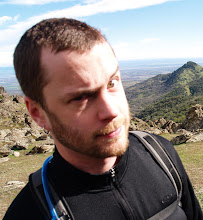
Break time on Fiske Peak summit. (l to r) Betty, Samantha, Jeremy.

A page from the summit log at Fiske Peak.

Shot from the Blue Ridge. I forgot to check the compass when I took this one. Snow Peak Wilderness maybe?

We roll with the mountain lions.

Mountain lion scat on the trail.

David taking in big views.

Spring wildflowers.

Lake Berryessa in the background to the south.

Day Two
We follow the riparian corridor of Fiske Creek back north to Rayhouse Road. Day two is mostly level, down in the creek bed. It features lots of wildlife, and great views of the ridge we traversed the day before.
Lost femur dept.

This snake's tail was trapped under the rock.

Did I mention this was Easter Morning? Easter (turkey) egg!

This rattlesnake was stretched out on a sunny stretch of fire road at the end of the hike. We accidently startled him and put him in this defensive pose. Don't tread on me!

Heading north out of the Cache Creek Wilderness. Glascock Mountain in the background.

Want to check it out? Yolo Hiker has tons of maps of the Cache Creek Wilderness.


Wow! very nice place, and nice pictures!!
ReplyDeletebackpacking tips
this are is not quite in the Wilderness area, just southeast of it.
ReplyDelete